Table of Contents
- Landfall in a Cold Spring: The Atlantic Crossing of 1602
- First Sight of the New Coast: Shoals, Fog, and Abundance
- Naming the Headland: Why “Cape Cod” Stuck
- The People Already There: Wampanoag Shores
- The Value of a Name: Fish, Trade, and English Strategy
- Sources from the Deck: Brereton and Archer Report
- A Fort on Cuttyhunk: The Brief Settlement Attempt
- Trade Goods and Dreams: Sassafras Fever in England
- Cross-Currents of Empire: Spain, France, and English Claims
- Risks and Misreadings: Weather, Maps, and Misconceptions
- Conflicts at the Edge: Tense Meetings and Mutual Gauges
- Mapping a Coastline: From Cape Cod to Martha’s Vineyard
- Legacies in Motion: From Gosnold to Jamestown
- Memory and Debate: What We Really Know
- Conclusion
- FAQs
- External Resource
- Internal Link
Article Summary: In May 1602, the English mariner Bartholomew Gosnold sailed along a fish-rich headland he would call Cape Cod. This article reconstructs that naming moment, the voyage that led to it, and the Indigenous world already flourishing there. It follows the crew’s plans for trade, a short-lived fort on Cuttyhunk, and the propaganda-laced reports that brought news home. By tracing rivalry, maps, and memory, we show how “bartholomew gosnold names cape cod” became an imperial prelude to Jamestown—and a durable place-name on global charts.
Why keep reading: The naming of Cape Cod seems simple, but it sits at the crossroads of empire, commerce, and encounter. What looked like a nautical footnote became a strategic claim, a cartographic fix, and a prologue to English colonization—contested, costly, and transformative for everyone on those shores.
At a glance:
- Event: English explorer Bartholomew Gosnold names “Cape Cod.”
- Date: Commonly given as 15 May 1602 (exact day debated in sources).
- Place: Outer Cape Cod, present-day Massachusetts, within Wampanoag homelands.
- Main figures: Bartholomew Gosnold; chroniclers John Brereton and Gabriel Archer; local Wampanoag communities.
- Why it mattered: Anchored English naming rights, fed a booming Atlantic trade vision, and foreshadowed settlement pressures culminating in Jamestown and beyond.
01 – Landfall in a Cold Spring: The Atlantic Crossing of 1602
In the late winter light of 1602, Bartholomew Gosnold left Falmouth in the bark Concord, aiming for a more direct Atlantic crossing than the looping routes of earlier English expeditions. His plan shaved time off a notoriously dangerous journey, gambling that speed could equal profit and proof of concept for future ventures.
They were not only chasing land; they were chasing a business model. The crew sought fish, furs, and especially sassafras, prized in England as a near-miraculous medicine. Sponsors at home expected a ledger that justified risk. Gosnold knew he had to return with a story, a map, and a hold worth counting.
By late spring, the ship reached colder waters and fickle wind belts, harried by fog that felt more like a force than a weather pattern. Men scanned the horizon from a pitching deck, eyes red from salt and smoke. Landfall would mean respite—but also decisions that could set the tone for English claims in the north.
This is where the phrase bartholomew gosnold names cape cod first belongs: among financiers’ hopes, crew fatigue, and a captain’s calculations. A name, once set to paper and spread by printers, could travel faster than any ship—staking a claim in the minds of readers who would never see the spray or feel the cold.
02 – First Sight of the New Coast: Shoals, Fog, and Abundance
As the coastline emerged from the May haze, the Concord’s crew noted shoals that rose like lurking reefs, a warning that these were both generous and treacherous waters. The shoreline bent into hooks and bars, promising inlets thick with life. The Atlantic here was not empty; it churned with maritime possibilities long used by others.
Gulls and the sea’s glittering skin signaled fish runs. For men who had been on short rations, the sight meant sustenance and wealth. A well-placed cape could become a maritime landmark, a reference point to guide future voyages. But it needed a name—something practical, memorable, and connected to what English merchants wanted to hear.
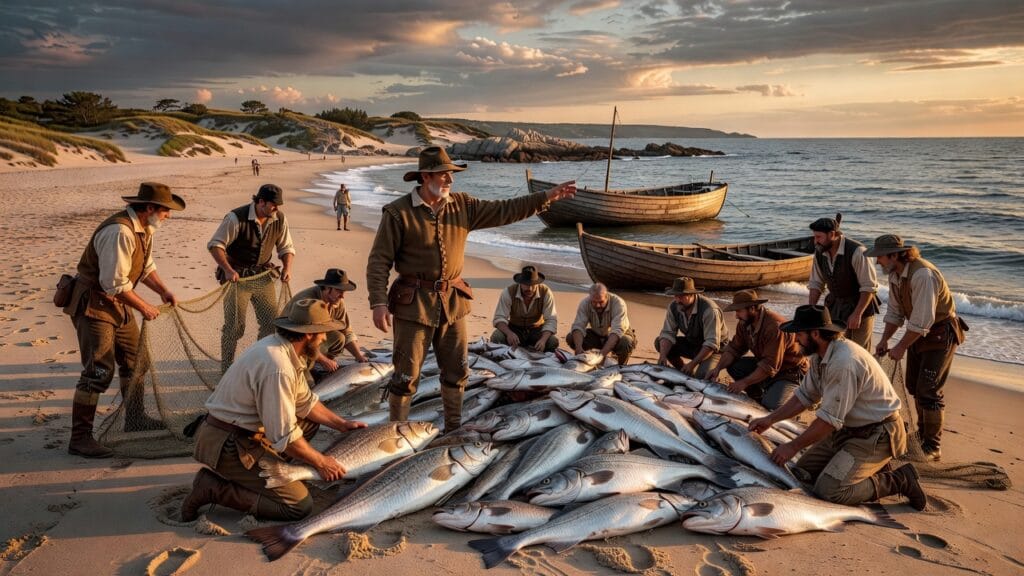
Brereton later described a readiness of cod that “took” as if the waters volunteered them. A place-name was often born from a crew’s first decisive abundance. In a world of mapmakers and merchants, the right word could turn the unknown into a navigable edge—a cape people could aim for with confidence rather than fear.
It was here, amid fogscapes and the clatter of lines, that the idea of Cape Cod surfaced, plain and descriptive. The coastal people had many names for these lands and waters; the English, arriving with logbooks and mercantile desires, would fix one that served their purposes and would outlast their first camp by centuries.
03 – Naming the Headland: Why “Cape Cod” Stuck
On or about 15 May 1602, the English account places Gosnold off the long sandy arm of Massachusetts that and later maps call Cape Cod. The crew reportedly hauled in cod in such number that the name felt inevitable to them—practical maritime shorthand polished into a cartographic label.
Why did it endure? Its precision helped. Mariners trusted place-names that matched their livelihoods. A cape rich in cod was both direction and invitation. It advertised resources to merchants in London and Bristol, turning the headland into a promise that future voyages could bank on.
The phrasing also traveled well in print. When bartholomew gosnold names cape cod, the words appear in reports that spread through England’s reading circles. Merchant letters and printed relations relished descriptive clarity. Adventure could titillate; dependable fisheries sold cargo. The name captured both in a single stroke.
04 – The People Already There: Wampanoag Shores
Long before the Concord’s wake foamed the outer cape, Wampanoag communities moved through seasonal rounds that braided land and sea. Shellfish banks, berry grounds, and whale strandings all had protocols, stories, and obligations. What English eyes saw as unbounded wilderness was already carefully held and stewarded.
Ethnographers and archaeologists point to settlements and camps along the outer and inner shore, including the Nauset area. Harvesting weirs, canoe routes, and kin ties formed a living map, one that did not need European place-names to function. The coast’s “abundance” was the result of knowledge layered over generations.
Contacts in 1602 were varied—gift exchanges, wary gestures, sometimes disappearances back into the dunes. Brereton’s and Archer’s texts note meetings and signals, though their lens is commercial. They measure potential trade, not sovereignty. Yet behind their words we glimpse partnerships and misunderstandings already in motion.
The English name did not erase Wampanoag geographies, but it added an external label that other Europeans would adopt. As more ships arrived, the descriptive “Cape Cod” on maps became a kind of funnel for people and pressures. It is easy to forget how fragile this world still was for all involved.
05 – The Value of a Name: Fish, Trade, and English Strategy
Names had budgets attached. A cape that promised fish, pelts, and sassafras could attract capital. London investors monitored these dispatches carefully. After decades of intermittent failures, England needed a northern story that did not end in wreckage or silence. A practical name suggested an actionable coast.
Mini timeline:
- 26 Mar 1602: Concord departs Falmouth, Cornwall.
- Mid-May 1602: Landfall and the naming of Cape Cod.
- Late May 1602: Exploration of Elizabeth Islands and Martha’s Vineyard.
- June–July 1602: Short-lived fort on Cuttyhunk; return to England.
In Elizabethan political arithmetic, visible success countered Spanish and French precedence. Basque and French fishermen already prowled these waters. An English name, especially one grounded in commodities, telegraphed commercial intent. It aligned geography with a ledger’s logic, making the headland a waypoint on future balance sheets.
Bartholomew gosnold names cape cod is therefore not merely an act of description. It is a brand launch in the idiom of the seventeenth century, a bid to demonstrate that England could translate exploration into repeatable profit. The audience back home—printers, patrons, and rivals—understood exactly what was being promised.
06 – Sources from the Deck: Brereton and Archer Report
We know the voyage largely through two texts: John Brereton’s published relation and Gabriel Archer’s manuscript account. Brereton’s A Briefe and True Relation reached readers quickly, shaped for curiosity and investment. Archer’s version, preserved later, offers a different texture—more knotwork of coasts and meetings, fewer flourishes.
Both men wrote under the flag of persuasion. They were not neutral diarists; they were advocates. Scholars note how such reports functioned as instruments to court backing. The line between description and salesmanship blurs, making it essential to read with caution where claims about abundance or compliance are too neat.
The surviving evidence points toward a mid-May naming, but the exact day remains uncertain when compared closely across accounts. Tides, winds, and a rolling ship can reorder memory. Modern historians remain cautious because the documentary record is fragmentary, even as its broad arc feels consistent with other early coastal voyages.
Yet the effect is beyond dispute. Once printed, “Cape Cod” entered the Atlantic discourse. The name’s simplicity magnified its authority. The royal rolls suggest a more administrative picture than later chronicles, but Brereton’s swift publication is what gave the headland its English echo beyond a single logbook.
07 – A Fort on Cuttyhunk: The Brief Settlement Attempt
From the cape, Gosnold and his crew threaded west to the Elizabeth Islands, finally choosing Cuttyhunk as a probable base. They erected a storehouse and a modest fortification, the kind of foothold meant to anchor trade in sassafras, pelts, and perhaps timber. The landscape promised resources; the exchange promised returns.
But this was only the beginning of their troubles. Internal disagreements surfaced over who would stay and who would sail home with the profits. The small garrison idea—leaving a few men to hold and gather goods—faltered under the weight of uncertainty, supply concerns, and a coastline they did not yet understand.
Meetings with local people were careful but not free from tension. Signals misread could spill into fear. Stories of theft or misunderstanding crept into the campfire talk, amplifying doubts. In the end, the logic of caution won. The fort’s promise gave way to withdrawal, and the crew re-embarked with what they had gathered.
The brief footprint on Cuttyhunk nonetheless mattered. It tested the model later refined in Virginia: minimal outlay, maximum claim, and a hope that Indigenous trade would bridge gaps. When it failed, the lesson traveled. The next attempt would come with bigger backing—and a far heavier human cost.
08 – Trade Goods and Dreams: Sassafras Fever in England
To understand why a fishy headland could tilt investors’ heads, recall sassafras fever. In early seventeenth-century England, sassafras bark and root were hawked as cures for syphilis and other ailments, fetching high prices. Reports of trees thick along northern coasts were, to financiers, as enticing as silver strikes.
Gosnold’s men cut and loaded what they could. Brereton’s language for abundance radiates optimism, the rhetoric of a salesman certain of his market. But even then, supply chains were more fragile than pamphlets admitted. The Atlantic could swallow opportunity as quickly as it revealed it, and monopolies cracked under competition.
Economists of empire now view Gosnold’s voyage as an early trial of extractive outposts—cheap infrastructure with quick turnover. If the land could not yield fast enough, ships would move on, leaving little behind but names. The victory solved one problem and created another: it put a price tag on a living coast.
That price tag, once affixed, did not come off. The name “Cape Cod” stood for fisheries, and by extension, for seasonal labor, credit extensions, and an exchange of goods that entrepreneurship and aggression would both shape. The English were not first in these waters, but their printed narratives would become unusually loud.
09 – Cross-Currents of Empire: Spain, France, and English Claims
Seen from Europe, the 1602 naming was a small move on a crowded chessboard. Spain’s imperial gravity pulled south and west; France pressed into the northeast with cartographers and traders. Basque fishermen exploited cod banks without fanfare. English mariners were latecomers, eager to write themselves onto crowded margins.
Cape Cod’s label was a form of paper sovereignty, though the sand would answer to no charter. France’s Samuel de Champlain mapped parts of this coast only a few years later, describing harbors and people with a mixture of respect and ambition. Competing atlases reveal a coastline alive with overlapping European intentions.
When bartholomew gosnold names cape cod, he is aligning England with a practice already honed by Spain and France: fix the map, then argue that the map invites you back. Naming was diplomatic theater and logistical planning in one. It promised return journeys; it demanded investors; it presaged conflict.
Put simply, Cape Cod became legible to London not as a home but as a supply. This did not collapse Indigenous presence, but it reframed the cape within imperial paperwork. Across the next years, rivalry would harden, and the soft claim of a name would be tested by harder acts onshore.
10 – Risks and Misreadings: Weather, Maps, and Misconceptions
Coastal pilots in 1602 grappled with unreliable instruments, shifting sands, and the Atlantic’s deceptive calm. Fog wrapped embayments and made familiar headlands seem to shift. A name like Cape Cod offered orientation, yet newcomers could still misjudge currents, overrun shoals, or miss shelter by a mile in poor visibility.
Contemporary sources suggest that latitude estimates were often sounder than coastal bearings. Mariners could fix their north–south position with sun and stars but struggled east–west, especially in tricky littorals. Reports exaggerating ease of entry were sometimes more sales pitch than seamanship manual, and later captains paid for the gap.
Early maps consolidated the cape’s hook, but its interior harbors remained ambiguously rendered for decades. The documentary record is fragmentary here; cartographers borrowed from one another as often as they verified anew. Errors acquired the weight of truth. Once printed, they invited ships to test them—sometimes dangerously.
This dynamic matters because it shows how a name could be accurate yet incomplete. “Cape Cod” signaled fish and a landmark. It did not teach safe passage across sandbars or respectful protocol in Wampanoag country. The open water between those lessons and English practice would remain perilous.
11 – Conflicts at the Edge: Tense Meetings and Mutual Gauges
Accounts of first contacts around the cape and adjacent islands describe wary exchanges—bracelets bartered for knives, arrows examined, oars watched. The English kept their ship close; the Wampanoag kept their distance and options. Trust grew in increments and fell in sudden drops when gestures misfired.
Later chroniclers claimed thefts on both sides, a familiar trope that could mask mutual probing for leverage. One side tested resolve by taking a tool; the other answered with a show of numbers. Each camp read the other through its own codes, sometimes seeing insult where there was merely unfamiliarity.
Claims that 1602 was peaceful must be balanced. Silence in the record is not proof of harmony; it can mark the limits of what reporters chose to say. Even when no arrows flew, the stakes were high. Every trade item carried a second meaning. Every word misheard could harden into grievance.
12 – Mapping a Coastline: From Cape Cod to Martha’s Vineyard
After rounding the cape, the Concord moved along a necklace of islands Gosnold named the Elizabeths, honoring the queen, and came upon a larger island he called Martha’s Vineyard. Why “Martha” has stirred debate—some say a daughter, others a relative of a sponsor. Brereton offers no conclusive explanation.
What matters more than the honorific is the mapping habit taking form. Headlands received descriptive English names tied to resources; islands received courtly nods to patrons or sovereigns. The practice encoded motive and allegiance into the very geometry of the coast, making maps into promotional pamphlets.
Champlain’s later surveys would refine the outlines, but the English names persisted, especially when republished by navigators like John Smith in 1616. As mariners copied charts, “Cape Cod” migrated from a single ship’s log into a European reference point. Cartographic repetition became a kind of empire by echo.
Of all those labels, the bluntness of “Cape Cod” remained its strength. Mariners did not have to remember a courtier’s name or mythic allusion; they tasted the fish the word invoked. When bartholomew gosnold names cape cod, he gives English pilots an index entry that feels like advice, not poetry.
13 – Legacies in Motion: From Gosnold to Jamestown
Gosnold’s 1602 experiment did not plant a lasting settlement, but it seeded conviction. Five years later, he was central to the founding of Jamestown, bringing with him the hard lessons of a temporary fort, strained supplies, and the necessity—however imperfectly learned—of sustained relations with Native polities.
In Virginia, he argued for more compact siting and better provisioning. He died in 1607, his influence diffused through men who had sailed with him and through policies inspired by his earlier New England trial. The line from the sandy cape to the James River is not straight, but it is traceable.
Empire is often built from failed prototypes. Cuttyhunk’s abandonment anticipated both caution and persistence. Investors who read Brereton in 1602 later funded bigger enterprises, convinced that the north could yield as surely as the Caribbean. The promise of “Cape Cod” fed a broader appetite for Atlantic footholds.
The name’s durability also shaped regional identity. It bundled fisheries, settlement, and seasonal labor into a single geographic brand. When merchants planned voyages or colonists imagined futures, the cape’s label functioned as shorthand for opportunity—obscuring, too often, the obligations owed to those who were already there.
14 – Memory and Debate: What We Really Know
Pinning the naming to 15 May 1602 is plausible but not certain. Brereton’s narrative cadence suggests mid-May, and some later compilations crystallized that into a day. Cross-checking Archer’s details introduces small tensions in timing. Modern historians treat the date as strong but not definitive, given navigational imprecision and editorial shaping.
Immediate consequence:
The headland became a recognizable waypoint on English maps, drawing fishermen and traders who mapped the banks with their nets and reinforced the name through use and print.
Long-term consequence:
“Cape Cod” entered the lexicon of colonization, its resources monetized and its presence on charts legitimizing further English intrusions, culminating in sustained settlements that reshaped Indigenous homelands.
The Liber Pontificalis preserves a later but influential version of succession in a different context; here, our analog is Hakluyt’s publishing network, which turned voyages into policy arguments. Printed relations did not merely report discovery—they instructed empire. That is why small uncertainties about dates matter less than the clarity of consequences.
When we write that bartholomew gosnold names cape cod, we compress a messy process into a neat phrase. Behind it stand currents of race, trade, faith, and disease, the lived realities of Wampanoag families, and European paper claims that stiffened into law. The name is a lens, not a full picture.
15 – Conclusion
A headland crowded with cod became a sentence that still guides ships and imaginations: Cape Cod. The moment when bartholomew gosnold names cape cod binds together a transient camp, a print shop in London, and the ancestral homelands of the Wampanoag. It shows how quickly a label can organize ambition and obscure costs.
The deeper meaning lies in the gap between naming and knowing. The English made a claim by ink and repetition; the Wampanoag sustained meaning by practice and memory. From that friction came Jamestown, fisheries, and a century of entanglements. The name endured because it was useful. Its legacy endures because it demands we read beyond the map.
16 – FAQs
- When did Gosnold name Cape Cod?
Most historians place the naming in mid-May 1602, often cited as 15 May. The exact day is debated due to differences across accounts and the imprecision common to sea logs of the era. - Where did the naming happen?
Off the sandy outer arm of present-day Massachusetts, within Wampanoag homelands. The crew observed abundant cod along the headland that now bears the name Cape Cod. - Who were the key figures?
Captain Bartholomew Gosnold led the voyage; John Brereton and Gabriel Archer recorded it. Wampanoag communities, including those near the Nauset area, were central to the encounters along the coast. - Why did Gosnold choose the name “Cape Cod”?
The crew reported hauling cod in great numbers, and a descriptive name served both navigational clarity and commercial messaging. It advertised resources to investors and mariners alike. - What were the consequences of the naming?
It strengthened English paper claims and guided subsequent voyages. Over time, increased traffic and settlement brought profound pressures on Indigenous lands, economies, and health, reshaping the region’s human geography. - What is the event’s legacy today?
“Cape Cod” remains a powerful geographic brand tied to fisheries, tourism, and regional identity. The phrase “bartholomew gosnold names cape cod” also anchors discussions about early English colonization and its effects on Wampanoag communities.
17 – External Resource
18 – Internal Link
Other Resources
- Encyclopaedia Britannica – general search for the exact subject
- Google Scholar – academic search for the exact subject
- Internet Archive – digital library search for the exact subject
Sources and References
-
Brereton, John. A Briefe Relation of the Description of Elizabeths Ile, and Some Others towards the North Part of Virginia. London: George Bishop, 1602 (early 1600s editions).
Note: Primary eyewitness account by a gentleman on Gosnold’s 1602 voyage. Describes the landfall on the New England coast, the naming of nearby places, interactions with Indigenous peoples, and provides one of the earliest narratives of the expedition that later became associated with the naming of Cape Cod. -
Arber, Edward (ed.). Captain John Smith: Works, 1608–1631. Birmingham: John Chamberlain, 1884.
Note: Critical edition of John Smith’s writings, including material on early English voyages to the New England coast and retrospective references to Gosnold’s exploration. Useful for contextualizing Gosnold’s 1602 voyage within the broader English efforts in “Virginia” and New England. -
Quinn, David B. North America from Earliest Discovery to First Settlements: The Norse Voyages to 1612. New York: Harper & Row, 1977.
Note: Scholarly narrative that situates Gosnold’s 1602 expedition in the longer history of European exploration of the North American Atlantic seaboard. Discusses the voyage’s route, commercial motives (notably the cod fishery and trade), and the significance of naming places such as Cape Cod. -
Kupperman, Karen Ordahl. Roanoke: The Abandoned Colony. 2nd ed. Lanham, MD: Rowman & Littlefield, 2007.
Note: Although focused on Roanoke, this book provides a careful analysis of late 16th- and early 17th‑century English colonial planning and exploration, including figures like Bartholomew Gosnold. It helps explain the strategic and economic rationale behind voyages to the New England coast and the broader “Virginia” region. -
Horn, James. A Land As God Made It: Jamestown and the Birth of America. New York: Basic Books, 2005.
Note: Modern scholarly account of early English colonization that devotes attention to Bartholomew Gosnold’s role as a promoter of colonization schemes and as a leader in the Jamestown venture. Useful for connecting the 1602 Cape Cod voyage to Gosnold’s later career and influence. -
Massachusetts Historical Society. “Bartholomew Gosnold and the Exploration of New England.” In Massachusetts: Colony to Commonwealth, digital exhibition, Massachusetts Historical Society.
Note: Museum/archival overview summarizing Gosnold’s 1602 voyage, including the approximate date of landfall, the naming of Cape Cod, and the subsequent impact on English geographical knowledge of New England. Supports details on date, location, and historical context. -
Cape Cod National Seashore (U.S. National Park Service). “Early European Exploration of Cape Cod.” National Park Service, U.S. Department of the Interior.
Note: Official interpretive material outlining the sequence of European contacts with the Cape Cod region, including Gosnold’s 1602 visit and the origin of the name “Cape Cod” in relation to the region’s abundant cod fisheries. -
“Gosnold, Bartholomew.” In Oxford Dictionary of National Biography. Oxford: Oxford University Press, online edition.
Note: Peer‑reviewed biographical entry summarizing Gosnold’s life, his 1602 voyage to New England, and the naming of Cape Cod. Corroborates key biographical facts, the date and purpose of the voyage, and Gosnold’s role in early English colonial enterprises.

