Table of Contents
- Whispers Beneath the Andes: Setting the Stage for Tungurahua
- A Volcano with a Memory: Tungurahua Before 1999
- The Year the Mountain Woke: Alarms in 1999
- Evacuation and Exile: Baños Empties Overnight
- Between Faith and Fear: Life in the Shadow of an Angry Mountain
- Ash on the Wind: The Eruptive Rhythm of the Early 2000s
- Fire in the Night Sky: The Dramatic Eruptions of 2006
- Surviving on the Edge: Farmers, Livestock, and Lost Harvests
- Science on the Crater’s Rim: Monitoring, Data, and Difficult Decisions
- Politics under Ash Clouds: Government, Conflict, and Crisis Management
- Faith, Ritual, and Resilience: Cultural Responses to the Eruption
- Tourism, Risk, and Spectacle: When Disaster Becomes an Attraction
- Families in Flux: Migration, Memory, and the Long Road Home
- The Later Roars: From 2010 to the Last Major Eruptions in 2016
- Counting the Cost: Economic, Social, and Environmental Consequences
- Lessons in Ash and Fire: Risk, Preparedness, and Global Volcanology
- Echoes That Still Resonate: Tungurahua in Ecuador’s National Memory
- Conclusion
- FAQs
- External Resource
- Internal Link
Article Summary: From 1999 to 2016, the tungurahua eruption ecuador transformed an entire region of the central Andes into a landscape of ash, anxiety, and unexpected resilience. This article traces the long awakening of the volcano, from the first seismic tremors to the towering ash plumes that repeatedly darkened the skies over Baños and surrounding communities. Through a blend of narrative scenes and historical analysis, it follows farmers exiled from their fields, scientists laboring on the crater’s rim, and families who refused to abandon the mountain they called home. The story explores how politics, religion, and economics collided in moments of crisis, revealing both tensions and acts of solidarity. It also examines how tourism, media, and spectacle reframed the risk, even as the volcano continued to roar. As the sequence of eruptions evolved and eventually waned after 2016, the region was left to reckon with damaged land, altered livelihoods, and powerful collective memories. In doing so, the article shows how a single long-lived eruption can reshape identity, policy, and the very way a country understands the capricious earth beneath its feet.
Whispers Beneath the Andes: Setting the Stage for Tungurahua
The central Ecuadorian Andes rise like a serrated wall against the sky, a chain of hardened fire and ancient myth. Among these peaks, Tungurahua stands both beautiful and ominous, a near-symmetrical cone wrapped in clouds and legends. For centuries, villagers pointed to its snow-dusted summit and spoke of the mountain as if it were a living presence, a being capable of anger and generosity alike. Long before the dramatic events of the tungurahua eruption ecuador between 1999 and 2016, the mountain had been a constant but quiet companion, looming above terraced fields, winding roads, and the pilgrimage town of Baños de Agua Santa. Its Quechua name is debated—perhaps “Throat of Fire,” perhaps “Cradle”—yet in either case it suggests an opening, a passageway between the calm world of humans and the tumultuous realm beneath the crust.
In the highland dawn, light spills over the steep flanks of Tungurahua, revealing a landscape sculpted by time and ash. Black volcanic soils feed green patchworks of maize, potatoes, beans, and pastures for cattle. Rivers cut deep ravines, their waters sometimes warmed by hot springs hidden in the folds of basalt. To the west, Baños sits in a precarious bowl near the Pastaza River, its churches and hostels crowded along narrow streets, its identity entwined with both tourism and devotion to the Virgin of the Holy Water. To the east, the land slides toward the Amazon basin, where clouds gather thick and the air grows heavy and wet. It is here, at this hinge between mountains and jungle, that Tungurahua has long asserted its will.
The volcano’s story is not simply geological; it is human, political, and spiritual. Its slopes bear evidence of earlier eruptions: old lava flows now cloaked in vegetation, buried soils, and subtle terraces where people once farmed before ash and fire forced them to yield. Oral histories recall days when the mountain spat smoke and villagers fled with little more than what they could carry on their backs. Yet by the late twentieth century, those memories had softened. The volcano had been quiescent since a cluster of activity in the early twentieth century. Children grew up hearing that Tungurahua was “asleep,” a giant whose anger belonged more to their grandparents’ time than their own. Houses crept farther up the slopes. New roads were carved into the hillsides, and past disasters became the stuff of stories told by the old to the skeptical young.
But deep below the apparent stillness, magma was moving. Tectonic plates grind together off the coast of Ecuador, forcing oceanic crust under the South American plate, melting rock and feeding a long volcanic arc. Tungurahua is one of the most active of these Andean volcanoes, part of a restless line that includes Cotopaxi and Sangay. By the 1990s, volcanologists watching this chain began to notice subtle changes in seismic patterns and gas emissions, small irregularities that suggested certain volcanoes were stirring. Most people living under Tungurahua’s broad triangular shadow did not yet know the language of seismographs and sulfur dioxide measurements. Their senses were tuned to different clues: the smell of damp soil after rain, the behavior of animals, the shifting moods of the sky.
It would not be long before both worlds—scientific monitoring and everyday observation—converged in a story of disruption that would span nearly two decades. What would become globally known as the tungurahua eruption ecuador was, at its heart, a prolonged negotiation between a mountain and the people living on its flanks. The volcano would send its warnings in tremors and rumbles, in ash and incandescent rock. The people would respond with evacuations, protests, prayers, and an extraordinary, stubborn resilience. But in the mid-1990s, as Ecuador drifted through political upheavals and economic uncertainty, the mountain’s whispers remained low, almost drowned out by human noise. Tungurahua was watching, waiting, building pressure in the deep, preparing to remind the country of forces older and stronger than any government decree.
A Volcano with a Memory: Tungurahua Before 1999
To understand the drama of the 1999–2016 cycle, it is necessary to step back into history, when Tungurahua’s eruptions were recorded in ink, memory, and myth rather than digital logs. Colonial chronicles from the seventeenth and eighteenth centuries refer to a “Sierra of fires,” where mountains would smoke and occasionally shower settlements with ash. Tungurahua was one of these, erupting intermittently but with enough force to imprint itself on local timekeeping. There was “before the ash,” “the year of the darkness,” “after the rivers turned muddy.” These were not abstract geological cycles; they were markers of harvests lost, homes abandoned, and altars erected in thanks for survival.
The eruptions of 1773 and 1886, for instance, left clear traces in the historical record and in the soil. Priests in Ambato and Riobamba noted days when ash fell like snow, dimming the sun and coating church roofs. Farmers spoke of animals panicking before tremors, of glowing columns rising above the summit at night. Yet even these significant episodes were part of the long rhythm of Andean life, a region accustomed to earthquakes, landslides, and the temper of its volcanoes. People adapted by building resilient communities, by diversifying crops, by weaving catastrophe into religious practice. When Tungurahua quieted down in the early twentieth century, many interpreted it as a truce.
The last major eruption before the modern cycle came in 1918, a violent phase that sent pyroclastic flows down the mountain and covered wide areas with ash. But in the decades that followed, activity dwindled. By the late twentieth century, the volcano was often described in guidebooks as “dormant.” The word offered comfort, though it was geologically misleading. A stratovolcano like Tungurahua, with a history of frequent eruptions, is rarely truly asleep. It is more accurate to say it was between chapters, its narrative paused but not concluded.
Meanwhile, Baños and surrounding villages deepened their roots on the slopes. Baños grew into a magnet for pilgrims seeking healing waters and for travelers drawn by waterfalls, hot springs, and the dramatic chasm of the Pastaza. Small hotels and hostels proliferated. Guides led visitors over trails that skirted old lava flows, often with little mention that these scars were not ancient but, in geological terms, disturbingly recent. The town’s basilica displayed ex-votos—small painted plaques thanking the Virgin of the Holy Water for miracles and near escapes, including from past volcanic threats. Yet for many, the Virgin’s protection seemed to have settled the matter. Tungurahua was there, but quiet. You could live a full life, it seemed, under its watch without ever hearing it roar.
By the early 1990s, Ecuador’s attention was fixed not on volcanoes but on politics and economics. The country weathered coups, hyperinflation, and social unrest. Rural communities grappled with poverty and migration, sending young people to cities or abroad. Development policies encouraged road building and agricultural expansion deeper into marginal lands, including high-risk volcanic zones. Old hazard maps, where they existed at all, were often ignored or relegated to academic shelves. The lessons of 1918 and earlier seemed, to many, like stories from another era.
Yet volcanoes have long memories. The same conduits that had carried magma to the surface in 1773, 1886, 1918 still threaded the crust beneath Tungurahua. Residual heat and slowly refilling magma chambers kept the system alive. As global volcanology evolved, scientists took renewed interest in Andean volcanoes, including this imposing cone in central Ecuador. In October 1988, the Instituto Geofísico of the Escuela Politécnica Nacional (IGEPN) began modern monitoring of Tungurahua, installing seismometers to catch the slightest quivers. Their work would prove crucial, though at the time it attracted little attention beyond technical circles. Sensors ticked quietly in the dark, recording the heartbeat of a volcano that most locals assumed had retired from serious outbursts.
By the mid-1990s, however, the seismometers were telling a different story. Slight increases in small earthquakes under the volcano, subtle changes in long-period events, hinted that magma might be on the move. Gas measurements, when possible, suggested modest but real variations in sulfur dioxide output—often a sign of fresh magma approaching shallower levels. It’s astonishing, isn’t it, how such minute signals, invisible and intangible to most of us, can foreshadow an upheaval that will displace tens of thousands? The scientists watched with concern, adjusting instruments, cross-checking data, and issuing cautious bulletins. They knew Tungurahua’s past; the mountain, they suspected, was preparing to repeat itself.
The Year the Mountain Woke: Alarms in 1999
The first clear alarm of the modern tungurahua eruption ecuador sequence came in September 1999. It began as a grumble—an uptick in seismic activity, then a deepening sense among volcanologists that the system was transitioning from rest to unrest. On September 28, 1999, Tungurahua produced the kind of signal that could no longer be interpreted as a passing mood. The volcano entered a phase of renewed activity marked by increasing tremors, harmonic tremor associated with magma movement, and small ash emissions.
For the scientists at IGEPN, the numbers on their screens carried heavy implications. Yet conveying these implications to authorities and to communities was a fraught process. A false alarm could devastate local economies and erode trust. A delayed alarm could cost lives. In early October, as fumarolic activity increased and small explosions were heard, meetings multiplied between the scientists, the Civil Defense, and the government. Contingency plans were dusted off. Evacuation routes were discussed in theory. Few yet realized how quickly these lines on paper would become desperate paths in the dark.
By mid-October, the nature of the activity changed. Stronger explosions sent ash plumes rising several kilometers into the sky. Fine particles drifted down on fields like an early, dirty snow. The volcano began to roar audibly, a low, menacing sound that rattled windows in Baños. Residents stepped outside to gaze up at their familiar mountain now crowned with an ugly gray column. Some felt a surge of fear; others responded with fatalistic shrugs. “It has always smoked,” older people said. “It is just reminding us it is there.”
The national government, grappling with a severe financial crisis that would soon culminate in dollarization, now had to decide how to respond to a restless volcano. On October 15, 1999, after a period of intense activity, the decision was made: the high-risk zone around Tungurahua, including the town of Baños, would be evacuated. It was an extraordinary move, displacing around 25,000 people almost overnight. Soldiers and police streamed into the area with buses and trucks. Loudspeakers blared orders. The message was stark: leave now, or risk being trapped if the volcano escalated.
Reactions varied sharply. Some families packed quickly, grabbing documents, a change of clothes, a few precious objects. Others argued, refusing to abandon livestock, fields, or shops that represented their life’s work. Rumors flew wildly—of imminent catastrophe, of pyroclastic flows already racing down the flanks, of hidden agendas driving the evacuation. For many, the immediate crisis was not the unseen magma but the visible presence of armed men telling them to go.
As dusk fell on Baños that October, the town took on an eerie atmosphere. Shop windows were shuttered. The basilica’s bells echoed in nearly empty streets. A light dusting of ash began to settle, soft and sinister. Convoys rolled out toward safer areas such as Ambato and Pelileo, headlights cutting through a haze that smelled like a mix of wet rock and sulfur. Stories later told of dogs left howling in deserted courtyards, of saints’ statues wrapped hastily in cloth, of farmers standing at the edge of the road watching their cattle wander in confusion.
This first dramatic act of the tungurahua eruption ecuador story set the tone for many of the conflicts that would follow. At the heart of it lay a difficult question: who had the right to decide when a risk became unacceptable? The state, relying on scientific advice, asserted its responsibility to protect lives. Many residents countered that they alone knew the mountain and the land intimately, and that their livelihoods, culture, and autonomy could not be evacuated as easily as bodies. Between these positions, Tungurahua continued to rumble, indifferent to human arguments over its meaning.
Evacuation and Exile: Baños Empties Overnight
The evacuation order transformed the central Andean corridor almost instantly. Baños, once vibrant with vendors selling melcocha candy and travelers soaking in thermal baths, became a near ghost town guarded by military checkpoints. Residents were scattered into hastily organized shelters, staying with relatives, or finding whatever temporary accommodation they could in nearby cities. Their destination was exile; its duration, unknown.
In Ambato, a city already struggling economically, gymnasiums and schools were converted into refuges. Mattresses lined floors. Families divided by the rush to leave slowly found one another again, or agonized over missing members. Municipalities, churches, and NGOs scrambled to provide food, blankets, and medical assistance. The sudden arrival of thousands of people strained local capacity. Lines for meals stretched long. Sanitation faltered. Privacy evaporated.
For many evacuees, the deepest shock was not the distant threat of lava but the immediate loss of home. In the shelters, time warped. Days were punctuated by announcements about the volcano, by rumors passed between cots, by restless attempts to reclaim a semblance of normal life. Some organized makeshift schools for children. Others looked for temporary work. Still others returned, clandestinely, toward the mountain. Within weeks, a pattern emerged: while official policy kept Baños closed, small groups found ways to slip past checkpoints, to tend to animals, to check on houses, to resist the idea that their link to the land could be severed by decree.
The government framed the evacuation as a necessary sacrifice to prevent a tragedy akin to those witnessed at other volcanoes, like Colombia’s Nevado del Ruiz in 1985, where around 23,000 people died in lahars triggered by an eruption. Volcanologists supported the caution; early phases of Tungurahua’s unrest were unpredictable, and the potential for deadly pyroclastic flows toward Baños was real. Yet as days turned into weeks, and the feared cataclysm did not materialize, frustration mounted among the displaced.
By December 1999, tension boiled over. Evacuees organized protests demanding the reopening of Baños. They argued that the economic and psychological toll of forced displacement was itself a form of disaster. Many insisted that they were willing to accept the volcanic risk in exchange for the right to live and work on their land. Road blockades appeared. Slogans were painted on walls. The conflict over Tungurahua now played out not only between magma and rock, but between citizens and their government.
In one dramatic episode, protesters marched toward Baños, confronting soldiers and tearing down barriers. The memory of that long procession, people chanting under a haze of volcanic cloud, still resonates in local narratives. As one participant later recalled, “We felt that if we did not return, we would lose not only our town but our dignity.” Under mounting pressure, authorities gradually relaxed restrictions. By early 2000, many residents had returned, even as the volcano continued to show signs of unrest.
The episode revealed something profound: volcanic hazard management is inseparable from questions of trust, representation, and historical grievance. Rural Andean communities, accustomed to being marginalized in national decision-making, perceived the evacuation as yet another instance where their voices were secondary. Meanwhile, scientists, who had correctly warned of danger, faced skepticism and at times hostility. Their instruments signaled that the story of the tungurahua eruption ecuador had only just begun. On the ground, however, people were already negotiating their own terms of coexistence with a mountain that refused to fit neatly into the categories of “safe” or “unsafe.”
Between Faith and Fear: Life in the Shadow of an Angry Mountain
With the return of many residents in 2000, life around Tungurahua entered a strange new phase: a tense coexistence with an unpredictable neighbor. The volcano did not revert to silence. Instead, it simmered, issuing intermittent explosions, gas emissions, and ash falls. The people, in turn, wove this volatility into their daily routines, balancing faith and fear with pragmatic adaptation.
In Baños, the church of the Virgin of the Holy Water took on renewed significance. Pilgrims had long come to thank the Virgin for miracles, but now the central miracle many asked for was simple: protection from the volcano. Candles flickered beneath paintings depicting past escapes from landslides and eruptions. Parishioners prayed, sometimes with quiet fervor, sometimes with open desperation. The basilica’s bells rang not just for masses but for special supplications, processions in which statues were carried through ash-dusted streets, their faces turned toward the shrouded summit.
Yet behind these devotional scenes, an undercurrent of fear persisted. Explosions from the mountain could arrive without warning, echoing through the valley like distant artillery. At night, when conditions were clear, people could sometimes see glowing rock tumbling down from the crater, incandescent trails tracing the volcano’s flanks. On such nights, conversations hushed. Families gathered around radios to listen for updates from scientists. Children peered anxiously toward the windows. But this was only the beginning of the long emotional negotiation that would define the era.
Some adapted by embracing a kind of fatalism infused with respect. “We were born here, we will die here,” older residents would say. “If the mountain wants us, it will take us.” Others turned their anxiety into action, attending community meetings, learning evacuation routes, and participating in volunteer brigades trained in disaster response. Schools held drills where students practiced lining up and moving quickly to designated safe zones. The abstract idea of “risk” became a lived daily reality, tested every time ash reappeared on roofs or animals grew nervy without apparent cause.
Religious interpretations, too, evolved. For some, the volcano’s renewed activity was seen as divine punishment for moral decline or social injustice. Pastors and priests preached about repentance and resilience. For others, especially among indigenous communities in the region, Tungurahua’s behavior was understood within older cosmologies in which mountains are powerful beings with whom humans must maintain a respectful relationship. Offerings and rituals were quietly renewed on certain slopes, where people asked the apu—the mountain spirit—for mercy or balance.
In the midst of this, the volcanologists continued their watch. They refined hazard maps, marking zones where pyroclastic flows, lahars, and heavy ash fall were most likely. They improved communication channels with local authorities and radio stations, hoping that timely warnings could mitigate the worst outcomes. Still, they knew that the kind of sustained eruptive behavior the volcano was entering made prediction complex. Tungurahua was neither erupting cataclysmically nor truly quiescent; it was in a protracted, unstable conversation with the surface. That ambiguity, more than any single blast, would shape the psychological toll on the people who lived under its gaze.
Ash on the Wind: The Eruptive Rhythm of the Early 2000s
From 2001 onward, Tungurahua settled into a relentless rhythm of intermittent eruptions that defined the early years of the new millennium for central Ecuador. Explosive events alternated with quieter periods, but the volcano rarely let the region forget its presence for long. Ash became a constant, unwelcome guest—falling on crops, infiltrating homes, turning clear streams into opaque gray channels.
In February 2000 and again in 2001–2002, heightened activity sent ash plumes rising several kilometers into the atmosphere. Winds carried the fine particles tens, even hundreds, of kilometers away. Towns like Ambato and Riobamba, far from the volcano’s base, found their streets dusted in gray. Airports occasionally shut down, as ash posed a serious risk to jet engines. On some days, the sun dimmed to a muted disk behind a veil of particulates. Life took on the texture of a perpetual dry season, when even a gentle breeze could kick up clouds of irritant dust.
For farmers, the ash was both enemy and, paradoxically, potential benefactor. In thin layers, volcanic ash can eventually enrich soils, adding minerals that enhance fertility. But in the short term, thick ashfall smothered plants, clogged irrigation systems, and poisoned livestock water sources. Pastures whitened, their grasses buried. Cows developed respiratory problems. Chickens scratched in vain at ashy ground. Farmers tried to shake ash from leaves, to cover water troughs, to improvise masks from cloths as they worked. Many watched entire harvests wither, their economic stability collapsing even without lava setting foot in their fields.
Schools and businesses adapted to a new normal of interruption. Classes were canceled when ashfall grew too heavy. Students coughed and rubbed at irritated eyes, their notebooks speckled with gray fingerprints. Shopkeepers wiped their counters constantly, in a losing battle against the incessant thin drizzle of grit. Laundry hung outside had to be rewashed. Roofs, especially the ubiquitous corrugated metal ones, groaned under the weight of accumulated ash after heavy events, occasionally collapsing under the load.
The volcano’s voice—the rumbles and booms that preceded major ash emissions—became a perverse kind of soundtrack. At night, when loud explosions occurred, phone lines lit up. People called one another, checked on relatives, listened for official bulletins. In the countryside, some recount sleeping with a change of clothes and important documents in a bag by the door, ready to flee if the lights went out and the mountain’s roar shifted into something more ominous. The distinction between “on alert” and “at home” blurred.
Globally, volcanologists watched Tungurahua as one of the most active volcanoes of its time. Articles and bulletins described its behavior, comparing it with similar long-lived eruptions in places like Montserrat. A paper from the early 2000s summarized the situation dryly: “Tungurahua has entered a phase of recurrent Vulcanian and Strombolian activity, characterized by sustained ash emission and moderate to strong explosions” (as referenced in a study published by the Instituto Geofísico). Behind such clinical language lay thousands of daily disruptions, coughs, anxieties, and small acts of adaptation.
The early 2000s established the pattern that would define the entire tungurahua eruption ecuador story: the volcano would escalate, relent, then escalate again, never quite granting the region the relief of true dormancy nor the closure of a single, finite catastrophe. Instead of one disaster, there would be many smaller ones, layered over years until they formed a single, sprawling chapter in Ecuador’s environmental and social history.
Fire in the Night Sky: The Dramatic Eruptions of 2006
If the early years were an extended foreword, 2006 was one of the central, fiery chapters of Tungurahua’s long eruption. That year, the volcano produced some of the most visually dramatic and deadly events of the entire sequence, etching searing images into the memories of those who witnessed them.
Through the first half of 2006, activity intensified. Seismographs recorded increasing tremor, and observers reported more frequent explosions and ash plumes. The summit glowed more often at night. By midyear, volcanologists warned that a major eruptive phase was likely. Suspicion and unease spread through nearby communities. Some families discussed evacuation plans; others insisted that the mountain had threatened such outbursts before and then calmed. But on August 14–16, Tungurahua demonstrated that its capacity for violence had not diminished.
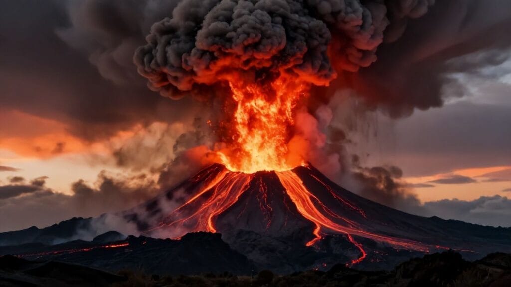
On the night of August 16, 2006, the volcano unleashed a powerful series of explosions. Columns of ash and gas shot high into the atmosphere, illuminated from below by the incandescent projectiles hurled from the crater. Red-hot blocks, some the size of small cars, arced in long trajectories before crashing down on the flanks. Pyroclastic flows—turbulent, searing avalanches of gas, ash, and rock—raced down ravines on the western and northwestern sides of the volcano, moving with terrifying speed toward villages and farmland.
Witnesses described the sound as otherworldly. Some compared it to an oncoming train, others to waves of thunder that did not stop. The sky, they said, seemed to be on fire. In towns like Penipe and Bilbao, people woke to a rain of ash and stones, the ground trembling beneath them. Emergency sirens, where available, wailed into the chaos. Many fled in panic, stumbling through darkness and airborne grit, clutching children and whatever they could grab.
The impact was devastating. Several villages were hit by pyroclastic flows and heavy ashfall, causing the deaths of at least six people—though locals sometimes dispute exact numbers—and the loss of homes and livestock. Fields that had already struggled under intermittent ash now lay buried under thick deposits. Roads were cut off by debris and lahars that followed the eruptive phase. The government declared a state of emergency. Once again, thousands were displaced.
Images of the eruption flashed around the world. Photographs captured glowing rivers of rock cascading down the mountain’s flanks, ash plumes towering like war clouds, and residents wearing improvised masks, faces streaked with sweat and ash. International media framed the event as a sudden disaster, yet for those living there, it was part of a long, grinding ordeal. The 2006 paroxysm, however, changed the calculus for many. The worst-case scenarios that scientists had warned about were no longer hypothetical.
In the aftermath, rescue and aid operations converged on the affected areas. Soldiers, firefighters, and volunteers searched for missing people, led animals to safer pastures, and distributed food and water. Temporary camps swelled. Psychologists arrived to help residents process the trauma of having watched their world burn. Yet, even as ash still smoldered on the slopes, some families ventured back to salvage what they could—tools, photographs, religious icons blackened but not destroyed.
The 2006 eruptions marked a turning point in the tungurahua eruption ecuador narrative. They validated the gravity of the hazard maps drawn in earlier years and underscored that this volcano could, at any time, escalate from nuisance to lethal force. For scientists, they provided invaluable data on eruption dynamics and pyroclastic flow behavior; for local communities, they imprinted fear and respect in equal measure. The mountain had spoken in its harshest voice in decades. Yet its story, astonishingly, was still far from finished.
Surviving on the Edge: Farmers, Livestock, and Lost Harvests
Beyond the dramatic footage of glowing lava and ash columns lies another, quieter catastrophe: the long-term struggle of rural families to sustain their livelihoods under persistent volcanic assault. The slopes of Tungurahua are home to scattered farms, many small and family-run, where generations have coaxed crops from the rich but treacherous land. Between 1999 and 2016, these households bore the brunt of the eruption’s slow violence.
Ashfall, even when not immediately catastrophic, exacted a cumulative toll. The first thin layers could be swept from roofs and shaken from leaves, leaving behind soil that, in time, might even benefit from mineral enrichment. But repeated heavy falls suffocated plants, reduced photosynthesis, and altered soil structure. Potatoes emerged stunted or did not emerge at all. Maize ears failed to develop properly. Fruit trees dropped their blossoms prematurely. Each failed harvest translated into debt, hunger, or forced migration.
Livestock, so central to Andean rural economies, faced their own ordeal. Cattle inhaled ash-laden air, leading to respiratory problems. When ash contaminated water sources, animals suffered intestinal distress. Pastures, once vibrant green, degraded into ashy fields with sparse, gritty forage. Many farmers tried to adapt by moving herds to less affected areas when possible, or by feeding stored fodder. But storage required resources many did not have, and moving animals was logistically complex. For some, the painful decision was to sell or slaughter livestock at low prices rather than watch them waste away.
The social fabric of these communities strained under the pressure. Young people, seeing little future in repeatedly devastated fields, left for cities like Quito or Guayaquil, or even emigrated abroad. Remittances from these migrants became a crucial lifeline for those who remained. Elderly parents tended the homesteads, their labor growing heavier just as their bodies aged. Village schools lost students. Traditional communal work systems, such as mingas—collective labor—had to grapple with new demands: clearing ash, repairing damaged irrigation canals, rebuilding simple shelter for people and animals alike.
Yet stories of ingenuity abounded. Some farmers experimented with different crop varieties thought to be more ash-tolerant, or adjusted planting schedules to avoid the periods when ashfall seemed most intense. Others diversified into beekeeping, small-scale commerce, or informal tourism, offering simple stays for visitors drawn paradoxically by the volcano’s danger. Agricultural extension agencies and NGOs introduced measures such as reinforced greenhouses or fodder storage systems, though their reach was uneven.
The human cost of the tungurahua eruption ecuador was thus measured not only in destroyed structures or immediate losses, but in the slow erosion of rural stability. A field buried under pumice could, in time, be cleared, but the trauma of watching one’s land repeatedly rendered uncertain left deeper scars. “The mountain no longer lets us plan,” one farmer reportedly told a journalist. “We plant, but we do not know if we will harvest. We build, but we do not know if we will stay.”
Science on the Crater’s Rim: Monitoring, Data, and Difficult Decisions
While farmers struggled in ash-laden fields, another group labored on the rocky heights: the volcanologists and technicians who sought to understand Tungurahua’s moods. Their work, both technical and deeply human, formed the backbone of risk management efforts throughout the long eruption.
The Instituto Geofísico’s observatory near Tungurahua became a hub of activity. Arrays of seismometers dotted the surrounding terrain, feeding continuous streams of data on ground motion. GPS stations recorded subtle deformations of the volcano’s flanks, seeking signs that magma was forcing its way upward. Gas monitoring devices measured emissions of sulfur dioxide and other volcanic gases, key indicators of magma movement and degassing processes. Infrasound sensors captured the low-frequency booms of explosions, while visual observations—through telescopes, cameras, and occasional helicopter overflights—rounded out the picture.
In the cramped observatory rooms, scientists took shifts, watching screens filled with squiggling lines and numerical readouts. They learned to recognize patterns: the build-up of long-period earthquakes preceding explosive phases, the sudden onset of harmonic tremor associated with magma rising in conduits, the quiet intervals that could mean either a lull or the ominous “plugging” of the system before a larger event. Each day they synthesized this information into reports for civil defense agencies, local authorities, and the public.
The responsibility weighed heavily. When to recommend evacuation? When to lower alert levels? False alarms risked undermining trust—essential in a context where previous evacuations had already sparked conflict. Underestimation risked tragedy. The line between caution and overreach was thin, and the volcano offered no guarantees.
Communication strategies evolved over time. Early in the crisis, information often moved through formal channels that were too slow or opaque for communities. As the years passed, more emphasis was placed on engaging directly with local leaders, holding public meetings, and using radio and even rudimentary SMS systems to relay warnings. Scientists made efforts to translate technical findings into accessible language, explaining what an increase in “LP events” or “SO2 flux” might mean for daily life. Some residents began to listen attentively to these bulletins before deciding whether to sleep at home or at temporary shelters on particularly restless nights.
International collaboration also shaped the monitoring effort. Researchers from other countries visited Tungurahua to install instruments, conduct field studies, and compare its behavior to that of other active volcanoes. In scientific journals, Tungurahua became a case study for understanding long-lived andesitic eruptions, plume dynamics, and lahar hazards. One study co-authored by Ecuadorian and foreign scientists noted that “the protracted eruption of Tungurahua offers a rare opportunity to analyze the interplay between magmatic and hydrothermal processes over decadal timescales” (citation embedded in the study’s discussion). Such work was not purely academic; its insights fed back into hazard assessment and global volcanic risk models.
Yet for the scientists themselves, the experience was not only about data. Many formed deep relationships with local communities, sharing meals in ash-covered villages, comforting families after destructive episodes, and listening to residents’ interpretations of the mountain. They, too, felt the strain of constant alertness, the fatigue of watching a volcano that never fully slept. Their role in the tungurahua eruption ecuador saga highlights a central reality of modern disaster management: knowledge is essential but never complete, and decisions must be made in the uncomfortable space between what is known, what is feared, and what is politically possible.
Politics under Ash Clouds: Government, Conflict, and Crisis Management
No long-running disaster unfolds in a political vacuum. From 1999 to 2016, Ecuador itself was undergoing profound transformations—economic crises, changes of government, and shifts in development priorities. Tungurahua’s eruption intersected with these larger currents, shaping and being shaped by them.
The 1999 evacuation, occurring during a severe financial meltdown, exposed the fragilities of state capacity. Resources for shelters, compensation, and long-term support were limited. Many evacuees felt that aid was insufficient and unevenly distributed. Accusations of favoritism or corruption in the distribution of food and materials sometimes flared, deepening mistrust. When residents of Baños forced their way back in 1999–2000, their defiance was not only against safety protocols but against what they perceived as a distant and unresponsive central government.
In the 2000s, under shifting administrations and later under President Rafael Correa’s government, disaster management policy evolved. There was greater emphasis on state-led infrastructure projects, improved coordination mechanisms, and a more assertive presence of central authorities in emergencies. Yet centralization also carried risks of sidelining local knowledge and agency. In the Tungurahua region, some communities welcomed stronger state involvement; others, particularly those with long histories of marginalization, remained wary.
After the 2006 eruptions, debates over compensation and resettlement intensified. Should those living in the highest-risk zones be permanently relocated? If so, who would pay, and where would they go? Proposals for resettlement often collided with residents’ insistence on their right to remain, their deep attachment to land that was not merely an economic asset but a core of identity. In some cases, new settlements were constructed, but many families continued to return, at least part-time, to their original homes to tend fields or animals.
The tungurahua eruption ecuador sequence thus highlighted a broader challenge facing Andean countries: how to design policies that acknowledge environmental risk without erasing the agency of those most exposed to it. Voluntary versus forced relocations, short-term emergency relief versus long-term development, technocratic assessments versus participatory planning—all became points of contention.
Political actors, too, sometimes leveraged the volcano in symbolic ways. Visits by presidents or ministers to ash-affected zones were occasions to demonstrate compassion—or, opponents claimed, to stage photo opportunities. Promises of aid and infrastructure improvements were tied to broader political narratives of national renewal or social justice. In local elections, candidates for mayor or provincial positions frequently cited their role in advocating for volcanic relief as proof of their commitment.
At the same time, civil society organizations, churches, and grassroots movements played critical intermediary roles. They provided assistance where state programs fell short, advocated for the rights of evacuees and farmers, and helped mediate between communities and scientific institutions. Their presence illustrated that managing a long-term disaster is not simply a matter of technical expertise and decrees, but of building and maintaining trust in a tangled web of relationships.
Faith, Ritual, and Resilience: Cultural Responses to the Eruption
As the years unfolded and Tungurahua’s bellowing became a grim part of the soundscape, cultural responses deepened and diversified. People did not merely endure; they interpreted, ritually engaged, and sometimes even aesthetically embraced the erupting mountain.
Religious practice remained at the forefront. In Baños, the cult of the Virgin of the Holy Water became ever more intertwined with the volcano. Processions took on added urgency during periods of heightened activity. On certain feast days, thousands of candles illuminated the streets as believers walked in solemn lines, praying for the Virgin’s intercession. Some carried photographs of loved ones who had migrated or died; others held small models of houses or fields, symbolic offerings pleading for protection. When major eruptions passed without mass casualties, many attributed this outcome not to hazard maps or evacuation plans, but to divine favor.
In indigenous and mestizo communities surrounding the mountain, older Andean cosmologies resurfaced with new vigor. The notion of the apu—a powerful mountain spirit—was invoked in stories explaining why Tungurahua had awakened. Perhaps, some said, the mountain was angry at environmental degradation, at deforestation and mining in the highlands. Others linked the eruptions to broader moral and social imbalances. Rituals involving offerings of food, drink, and coca leaves were performed at certain vantage points, seeking to reestablish harmony. These practices coexisted, sometimes uneasily, with Catholic devotions and with the rationalism of modern science.
Artists responded as well. Painters and photographers captured ash-darkened skies, glowing craters, and the contrast between fragile human dwellings and the looming cone above them. Poets invoked Tungurahua as a metaphor for internal turmoil or political rage. Local musicians composed songs about exile, return, and defiance, their lyrics weaving volcanic imagery with everyday concerns. In some cases, these works were quietly critical of state policies; in others, they celebrated communal solidarity under duress.
Memory-making became a collective act. Community members recounted where they were during the 1999 evacuation, the 2006 eruptions, or particular days when ash fell so thick they had to turn on lights at midday. These stories, told to children and visitors alike, gradually formed a shared narrative in which survival itself was a source of pride. “We are people of the volcano,” some would say, meaning not that they were defined only by suffering, but that they had learned to navigate a world where the ground’s stability could never be guaranteed.
Importantly, these cultural responses did not negate scientific knowledge; rather, they created parallel frameworks for making sense of the same phenomena. A person might listen to a volcanologist’s explanation of magma ascent and gas pressure, then attend mass to thank the Virgin for a narrow escape, and later sprinkle chicha on the ground as an offering to the mountain. In this layering of belief systems lay a key aspect of resilience: an ability to draw from multiple sources of meaning in the face of ongoing uncertainty.
Tourism, Risk, and Spectacle: When Disaster Becomes an Attraction
In a paradox that has become increasingly common around the world, the same forces that threatened life and livelihood at Tungurahua also drew outsiders seeking thrill, awe, and a closer proximity to raw geological power. Tourism, long a central pillar of Baños’ economy, adapted not only to survive the eruption, but in some ways to capitalize on it.
Before 1999, Baños was known primarily for its hot springs, waterfalls, and religious pilgrimages. After the eruption began, a new allure emerged: the chance to see an active volcano up close. Tour agencies began to advertise night excursions to viewpoints like the famous “La Casa del Árbol,” where, during active phases, visitors could watch glowing bombs and incandescent flows streak down the mountain’s dark slopes. Photographs of tourists swinging on a wooden swing over a steep abyss, Tungurahua fuming in the background, circulated widely on social media and travel blogs.
Risk, here, became part of the package. Guides had to navigate a complex moral and practical terrain: bringing clients close enough to feel the mountain’s power without exposing them to genuine danger. Authorities periodically closed certain routes during heightened activity, but enforcement could be inconsistent. Some locals, needing income in an economy shaken by ash and evacuation, were tempted to push boundaries. Visitors, often unfamiliar with volcanic hazards, sometimes interpreted official warnings as mere suggestions, assuming that if tours were operating, the situation must be safe.
Not all tourism was adrenaline-driven. Some travelers came with a more reflective purpose, drawn by stories of resilience and seeking to understand how communities lived under chronic threat. They stayed in family-run hostels, participated in local festivals, and listened to residents’ accounts. In doing so, they contributed economically while also carrying away more nuanced narratives of the tungurahua eruption ecuador, in contrast to sensationalist media images of lava and panic.
Still, the transformation of disaster into spectacle raised difficult questions. Whose stories were highlighted, and whose suffering was backgrounded in the pursuit of dramatic vistas? Did the influx of visitors during quieter periods truly benefit the most affected, or did it mainly enrich certain sectors? How could authorities harness tourism’s economic potential without allowing it to erode hard-won safety cultures?
Over time, some positive synergies emerged. Risk communication efforts began to include guidance for tourists, not just residents. Local guides received training on volcanic hazards, helping them serve as informal educators as well as entrepreneurs. Museums and interpretive centers highlighted both scientific and social dimensions of the eruption, encouraging visitors to see Tungurahua not only as a fiery spectacle but as a shaper of human history and identity in central Ecuador.
Families in Flux: Migration, Memory, and the Long Road Home
Any account of Tungurahua’s long eruption must reckon with its role in reshaping family trajectories. Volcanic ash and uncertainty became catalysts for migration, altering where people lived, how they identified themselves, and how they told their family stories.
For some, displacement was temporary. They left during the most intense episodes—1999, 2006, and later spikes in activity—then returned as soon as authorities allowed, or before. Children born during these periods grew up with divided senses of home: a physical house near Tungurahua, and the school shelters or relatives’ homes in distant towns where they had spent formative months.
For others, especially those who lost fields, houses, or livestock in the worst-affected zones, the volcano accelerated a move that economic pressures had already been pushing: migration to cities or abroad. Families from the Tungurahua region joined the broader wave of Ecuadorians who traveled to Spain, the United States, Italy, and elsewhere, seeking jobs to support those who remained. The money they sent back helped rebuild homes, fund new roofs strong enough to bear ash, or pay for children’s education. Yet this financial support came at the price of separation, of grandparents raising grandchildren while parents navigated foreign lands.
Stories circulated of return as well. Some migrants, having spent years abroad, came back with savings to invest in small businesses in Baños or nearby towns—restaurants, hostels, tour companies, shops. They brought with them new perspectives on risk and opportunity. To these returnees, Tungurahua was both a threat and a brand, a defining feature of the region that could be harnessed cautiously for economic revival.
Memory stitched these migrations together. Families kept photographs of their houses blanketed in ash, of lines at food distribution points, of children wearing masks during thick ashfalls. These images joined more joyful ones in albums, reinforcing the sense that the volcano’s presence was woven into their personal and collective identities. Oral histories, recorded by local researchers and occasionally by visiting scholars, captured the nuance of these experiences. People spoke not only of fear and loss, but of solidarity in shelters, of humor in shared hardship, of the strange beauty of watching lightning crackle within towering ash clouds.
In this way, the tungurahua eruption ecuador became a generational reference point. Younger people might ask their elders, “Where were you during the big eruption?” much as other societies refer to major earthquakes or political upheavals. Answers varied, but the shared frame remained. The mountain had made itself a part of family lore, an unpredictable relative who had disrupted lives but also, in a complex way, bound them more tightly together.
The Later Roars: From 2010 to the Last Major Eruptions in 2016
After the dramatic chapters of the early and mid-2000s, one might have hoped that Tungurahua would slowly drift back into dormancy. Instead, the volcano entered the 2010s with renewed energy, producing a series of significant eruptions that, while less deadly than 2006, reinforced the sense that the crisis was not yet over.
In January and February 2010, Tungurahua erupted vigorously, sending ash columns up to 8 kilometers high and prompting new evacuations. Pyroclastic flows descended ravines on the northwestern flank, burning vegetation and reminding residents that the volcano still had the capacity for rapid escalation. Ashfall again affected wide areas, with flights disrupted and schools closed. For many, the repetition itself was demoralizing. “Again?” people asked, looking up at the familiar darkening sky. “How long will this continue?”
Further eruptive phases occurred in 2012, 2013, and 2014, each with its own pattern of explosions, ash plumes, and lava fountains. Science and response capacities were by now better developed; hazard maps had been refined, communication systems improved, and communities more accustomed to interpreting alert levels. As a result, casualties remained relatively low compared to what might have been expected from such sustained activity. Yet the economic and psychological costs accumulated. Each episode disrupted planting cycles, tourism bookings, and schooling. Each ashfall meant another round of cleaning, repairing, and coping.
One notable phase came in February 2014, when Tungurahua produced powerful explosions audible for kilometers, accompanied by shock waves that shattered windows in nearby areas. Ash plumes reached altitudes of 13–14 kilometers, affecting air traffic and sparking new images of the volcano in international news outlets. The spectacle was undeniable: photos showed the cone silhouetted against a sky incised by a massive, mushrooming plume, lightning flickering within. For scientists, these events offered valuable insights into eruption column dynamics. For residents, they were yet another reminder that the mountain’s patience was limited.
By 2015–2016, activity began to show signs of gradual decline. There were still eruptions, including episodes in February–March 2016 that sent ash plumes high and produced pyroclastic flows, but the overall intensity diminished compared to the peak years. Monitors recorded fewer large explosions and a general downward trend in seismic energy release. The magma supply, it seemed, was waning—at least for now.
Officially, by late 2016 and the years that followed, Tungurahua was considered to have returned to a state of low-level activity. The continuous eruptive phase that had begun in 1999 had effectively ended, though the volcano remained classified as active and capable of future unrest. For those who had lived through its 17-year drama, the quieter summit was both a relief and a source of unease. Could they trust it? Was this truly the end of the story or merely another pause, like the one that had lulled earlier generations into a sense of security before 1999?
The long arc of the tungurahua eruption ecuador thus bent toward a kind of fragile calm. Ash-dusted roofs were repainted. Fields, in time, recovered some of their productivity. Tourists flooded Baños again, many blissfully unaware that, not long before, this had been an epicenter of near-constant volcanic anxiety. Yet for those who had watched the mountain breathe fire, the landscape would never again be simply picturesque. It was, and would remain, charged with memory.
Counting the Cost: Economic, Social, and Environmental Consequences
Journals and official reports attempt to quantify the impact of Tungurahua’s eruption in numbers: hectares of crops lost, houses destroyed or damaged, livestock killed, economic losses measured in millions of dollars. Such figures are important—they inform policy, guide aid, and enter the historical record. Yet they can only partially capture the layered consequences of nearly two decades under intermittent siege from the sky.
Economically, agriculture took repeated hits. In the province of Tungurahua and neighboring areas, crop yields dipped substantially during heavy ash years. Some estimates over the period suggest losses of tens of millions of dollars in the agricultural sector alone, though precise figures vary by source and methodology. Small-scale farmers were particularly vulnerable; without significant savings or access to credit, a single bad season could tip them into long-term debt or force the sale of land. Over time, this contributed to land-use changes: some marginal plots were abandoned, while others shifted to less demanding or more resilient crops.
Tourism showed a more complex pattern. In the immediate aftermath of major eruptions, tourist numbers plummeted. Roads were cut, images of destruction scared off potential visitors, and businesses in Baños and nearby areas suffered. But during quieter intervals, the allure of the “town under the volcano” actually drew increased interest. Hostels and tour operators marketed both the beauty and the volatility of the landscape. As a result, tourism revenues oscillated but did not collapse, and in some years exceeded pre-eruption levels. This economic pillar helped sustain the region, but also exposed it to boom-and-bust cycles tied not only to global trends but to the mountain’s whims.
Socially, the eruption deepened existing inequalities in some respects while fostering solidarity in others. Wealthier households and businesses were better positioned to adapt—by moving temporarily, investing in reinforced structures, or shifting economic activities. Poorer families, especially in rural zones, bore the brunt of crop and livestock losses and had fewer options for relocation or diversification. Yet community responses often cut across class lines: mingas to clear ash, volunteer brigades for emergency response, and church-based assistance networks stitched people together in practical ways.
Environmentally, the eruption both damaged and renewed. Forests and high-altitude páramo vegetation suffered where pyroclastic flows, heavy ash, and lahars passed. Rivers temporarily choked with sediment, affecting aquatic life and downstream hydrology. Yet volcanic ash also brought new minerals to the soil, and over years, many affected areas saw a rebound in plant productivity. In some ravines, fresh deposits of pyroclastic material formed the substrate for ecological succession, with pioneer species slowly colonizing the bare, gray surfaces. The landscape became a patchwork of old and new, destruction and regeneration layered visibly on the slopes.
Public health impacts included increased respiratory problems, eye irritation, and stress-related conditions. Clinics reported more cases of bronchitis and asthma flare-ups during heavy ash episodes, especially among children and the elderly. Masks, eye drops, and educational campaigns on how to deal with ash became standard parts of public health strategy. Mental health, though harder to quantify, was clearly affected. Living with a chronically active volcano meant living with chronic uncertainty—a condition linked in studies worldwide to anxiety, depression, and other psychological strains.
Yet there was another, less tangible cost: the alteration of people’s relationship with place. Fields once considered stable investments became, in some minds, conditional holdings, always at risk of being reclaimed by the mountain. Houses were built with evacuation in mind. This shift did not necessarily drive people away, but it changed the emotional and symbolic weight of “home.”
Lessons in Ash and Fire: Risk, Preparedness, and Global Volcanology
The long, complex story of Tungurahua’s eruption did more than reshape a region; it also enriched global understanding of volcanic risk and the ways societies can, and sometimes must, live with persistent threats. For disaster researchers and volcanologists, Tungurahua became a textbook case of how protracted eruptions challenge conventional models of hazard and preparedness.
One lesson concerned the nature of “disaster.” Traditionally, disaster is framed as a discrete event: a major earthquake, a single cataclysmic explosion. Tungurahua forced a reevaluation. Here was an eruption that, while punctuated by acute crises like 2006, unfolded as a drawn-out process. The line between emergency and normal life blurred. Preparedness could not be a matter of occasional drills; it had to become a habitual mode of existence. This insight has implications far beyond Ecuador, for communities living near other long-active volcanoes in places like Indonesia, Italy, and the Caribbean.
Another lesson involved communication and trust. The recurring conflicts over evacuation orders, alert levels, and risk perception underscored that technical accuracy is necessary but insufficient. Scientific institutions must build relationships with communities over time, listening as well as speaking, incorporating local knowledge where appropriate, and acknowledging uncertainty honestly. In the Tungurahua case, the gradual evolution toward more participatory communication models is often cited in disaster studies as an example of learning in action, even if tensions never fully disappeared.
On the technical side, Tungurahua provided a wealth of data. The continuous monitoring from 1999 onward created one of the more detailed records of a long-lived andesitic eruption available anywhere. This allowed researchers to explore links between seismicity, gas emissions, deformation, and eruptive style over nearly two decades—a rare span in volcanology. These findings fed into models of magma plumbing systems, eruption forecasting, and ash dispersal prediction. Airline safety protocols, for instance, benefited from better understanding of ash plume generation and flight-level impacts, particularly during the higher plumes of 2006 and 2014.
Emergency management institutions in Ecuador also drew structural lessons. The Tungurahua experience contributed to reforms in national risk management frameworks, prompting clearer delineation of responsibilities between national, provincial, and local authorities, and greater investment in early warning systems. Subsequent responses to other volcanic and seismic events in the country were informed by both the successes and failures observed at Tungurahua.
At a more philosophical level, the eruption invited reflection on what it means to call a place “home” in geologically volatile regions. Around the world, millions live near volcanoes, drawn by fertile soils, available water, cultural ties, and sometimes sheer economic necessity. The idea of simply relocating them to “safer” zones is often unrealistic or unjust. Tungurahua’s villages demonstrated that coexistence, while risky, can be managed through a blend of science, local practice, and cultural adaptation—though never without tension and loss.
Echoes That Still Resonate: Tungurahua in Ecuador’s National Memory
Today, when Ecuadorians speak of recent national traumas and trials, they list earthquakes, economic crises, and, invariably, the long shadow of Tungurahua. The eruption has entered the country’s narrative not as a brief catastrophe but as a defining chapter of the turn of the twenty-first century.
School textbooks mention Tungurahua alongside other major volcanoes like Pichincha and Reventador, highlighting its 1999–2016 activity as an example of sustained hazard. Documentaries intercut footage of ashfalls and lava flows with interviews of scientists and residents, crafting a storyline of danger, resilience, and learning. Museum exhibits in Quito and elsewhere include photographs and artifacts from the eruption: masks blackened with ash, fragments of roofing, personal items recovered from destroyed homes.
In the region itself, memorials and subtle markers keep memory alive. Some villages have small plaques honoring those who died in the 2006 events. The viewpoints from which people watched the volcano’s fiery displays have become part of local tourist circuits, but also of personal pilgrimage routes. Festivals incorporate references to the eruption—floats depicting the volcano, dances that dramatize flight and return, songs that recall nights lit by fire.
Yet perhaps the most enduring echo lies in altered senses of time and possibility. For those who lived through the tungurahua eruption ecuador years, life is now punctuated by volcanic phases: “before 1999,” “after the big eruption,” “when it finally quieted.” Plans for the future—building a house, planting a new orchard, sending a child to university—are made with a greater awareness that the ground itself may intervene. This awareness, far from paralyzing, has in many cases spurred a deeper commitment to community, to shared preparation, and to cherishing periods of calm.
Nationally, Tungurahua stands as a reminder of Ecuador’s position on the Pacific Ring of Fire, a country where beauty and danger are frequently intertwined. The snow-capped cone of Cotopaxi, the remote plume of Sangay, the restless crater of Reventador—all are now viewed through a lens sharpened by what happened at Tungurahua. The mountain’s long eruption taught not only its immediate neighbors, but the nation as a whole, that the earth’s deep processes are not background scenery but active agents in history.
And yet, for all the ash, noise, and fear it generated, Tungurahua also became a stage on which some of the best of human capacity was displayed: courage in the face of uncertainty, solidarity across class and regional lines, creativity in adapting to a new normal. These, too, are part of its legacy.
Conclusion
The 1999–2016 Tungurahua eruption was not a single disaster but a prolonged negotiation between a restless volcano and the communities woven around its base. Over seventeen years, the mountain roared, whispered, threatened, and occasionally devastated. In response, people fled, returned, rebuilt, argued, prayed, measured, and learned. The saga of the tungurahua eruption ecuador thus transcends the boundaries of geology, entering realms of politics, culture, economics, and personal memory.
From the first tremors that prompted the 1999 evacuation to the spectacular ash columns of 2006 and the later bursts of the 2010s, Tungurahua reminded Ecuador that its mountains are alive in the most literal sense. The volcano reshaped landscapes and livelihoods, forced improvements in monitoring and risk governance, and left behind a mosaic of physical and emotional scars. It also created unlikely forms of opportunity—tourism built on awe and danger, new scientific collaborations, and experiments in community-based preparedness.
For those who lived through it, the eruption’s end does not mean a return to the innocence of the pre-1999 years. The mountain’s apparent calm is now read differently, its silence recognized as temporary rather than permanent. Houses are built with escape routes in mind; farmers hedge their bets with diversified income sources; children learn both the names of volcanic gases and the prayers offered to protective saints.
Yet there is also a kind of peace in this hard-earned realism. To acknowledge that the ground can move, that ash can fall again, is not to surrender to fear. It is to inhabit the Andes as they are: dynamic, at times dangerous, but also profoundly home. The story of Tungurahua does not end with the fading of its last major plume in 2016. It persists in soil and stone, in scientific datasets and family stories, in the way people glance up at the cone on a clear morning, gauging the shape of the clouds above its summit. Someday, the volcano will almost certainly speak again. When it does, it will find a region transformed by the lessons of ash and fire, better prepared, perhaps, but still negotiating the terms of coexistence with a mountain that will always have the last word.
FAQs
- What and where is Tungurahua?
Tungurahua is a steep, active stratovolcano located in central Ecuador, near the town of Baños de Agua Santa. Rising to about 5,023 meters above sea level, it forms part of the Eastern Cordillera of the Andes and sits along the boundary between the highlands and the Amazon basin. - When did the 1999–2016 Tungurahua eruption begin and end?
The long eruptive period is generally considered to have begun with renewed unrest and explosive activity in September–October 1999. After years of intermittent eruptions, ash emissions, and pyroclastic flows, activity declined significantly after 2016, marking the end of that particular eruptive phase, though the volcano remains active. - How did the tungurahua eruption ecuador affect nearby communities?
The eruption led to repeated evacuations, destruction of homes and infrastructure in some villages, heavy impacts on agriculture and livestock, and ongoing ashfall affecting daily life in towns like Baños, Penipe, and Ambato. It also triggered migration, strained local economies, and reshaped cultural practices and risk awareness across the region. - How was Tungurahua monitored during the eruption?
The Instituto Geofísico of the Escuela Politécnica Nacional (IGEPN) monitored Tungurahua using seismometers, GPS stations, gas sensors, infrasound, visual observations, and satellite data. This allowed scientists to track magma movement, eruption intensity, and ash plume heights, providing crucial information for civil defense decisions and public warnings. - Was tourism to Baños completely stopped during the eruption?
Tourism declined sharply during major eruptive episodes and evacuations, especially in 1999 and 2006, but it never disappeared entirely. During quieter intervals, tourism rebounded and even grew, with some visitors specifically attracted by the chance to observe an active volcano from safe viewpoints. - Did the eruption have long-term environmental benefits?
In the short term, heavy ashfall and pyroclastic flows damaged vegetation, contaminated water, and disrupted ecosystems. Over longer timescales, however, volcanic ash can enrich soils with minerals, and many affected areas gradually saw improved fertility and ecological regeneration, illustrating the dual destructive and creative roles of volcanism. - Is Tungurahua still dangerous today?
Yes. Although the intense eruptive phase of 1999–2016 has ended, Tungurahua is still an active volcano with a history of frequent eruptions. Monitoring continues, and hazard maps remain in place to guide future preparedness and, if necessary, evacuations. - What lessons did the Tungurahua eruption offer for disaster management?
The eruption highlighted the challenges of managing long-duration crises, the importance of building trust between scientists, authorities, and communities, and the need for flexible, participatory approaches to evacuation and resettlement. It also underscored the value of continuous monitoring and clear communication for reducing loss of life in volcanic regions.
External Resource
Internal Link
Other Resources
- Encyclopaedia Britannica – general search for the exact subject
- Google Scholar – academic search for the exact subject
- Internet Archive – digital library search for the exact subject